TerraDat has many years experience in the imaging and mapping business and we specialise in offering innovative solutions to a wide range of applications from accident investigation, heritage work through to geotechnics.
More information can be found below about our PHOTOGRAMMETRY MAPPING SERVICES, AERIAL PHOTOGRAPHY
and our SOFTWARE TRAINING capabilities.
Photogrammetry Modeling and Mapping Services
TerraGeomatics provides a comprehensive service for individuals and companies who require reliable, high quality survey solutions.
Using our state of the art software and instrumentation, we can produce data for a fraction of the cost of conventional methods, which makes repeat monitoring surveys, or surveys in remote regions a real possibility.
* Photogrammetry picks up a level of detail that can not be obtained through any other surveying technique.
* Return visits to pick up missed detail are reduced.
* Reduction in costly field time.
* Drawing production is fast, accurate and easy because pictures of the object are
always available to identify features accurately and completely
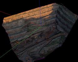
* Sites with difficult or hazardous access can be surveyed in complete safety. (ie
bridges, high traffic areas, or the cliff above)
* Drawings are in 3 dimensions (ie height of cliff) * Photogrammetry provides a
flexible level of accuracy to suit user needs.
* The more detail on the site to be surveyed, the easier it is to survey the
site.
* Photogrammetry provides a supplemental products as part of the drawing production.
For example aerial photographs or site photographs.
Click here to view some applications for our services.
Training and Support
We are the authorised dealer for Topcon’s Imagemaster Photogrammetry software. If you think photogrammetry may provide you with a solution for your mapping or monitoring needs, we can offer a comprehensive pre-sales consultation service and post sales technical support. If you decide to purchase a licence, we offer inclusive onsite training and from thereon rapid online support.

“Taking Photography to New Heights”
We can offer a full range of elevated high resolution digital photography utilizing our high-viewpoint remote controlled camera platforms and remote controlled airborne vehicles. These include: Remote controlled “Draganflyer” Helicopters, Kite Aerial
Photography (KAP), Helium Balloons (Helikites) and telescopic masts, so there is a solution to suit every situation.
Elevated photography is ideal for:
|
 |
What will I get?
We use high resolution digital cameras, and can provide the raw / processed image, or turn the image into a large format poster or a framed print. It is also possible to record video footage and burn this onto a DVD on site if required.
Where do you operate?
All over the World! We have taken pictures for clients as far afield as Iceland, Kazakstan, Australia, New Zealand and Mexico. We’re based from the UK, however most of our airborne systems fit into a small suitcase therefore are highly portable.